Responsive Menu

SURVEY & ENGINEERING

SOLUTIONS

Specialists in Software Solutions & Survey Equipment

SURVEY & ENGINEERING

SOLUTIONS

Specialists in Software Solutions & Survey Equipment

MODEL MAKER SYSTEMS SOFTWARE SOLUTIONS

Intuitive, Trusted and Affordable.

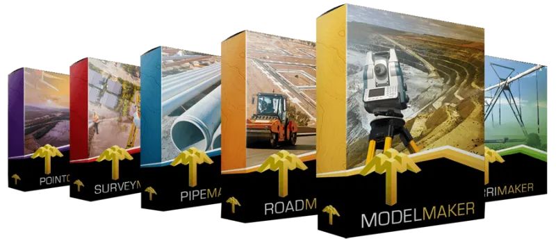
Model Maker Systems software is the trusted choice of surveyors, contractors and engineers around the globe. As an authorised dealer, we offer the full suite of solutions to streamline every project, from site planning to machine-control. We offer comprehensive support and various levels of training in the use of every aspect of the software.

Ideal for:

  • Technical & Land Surveying

  • Civil Engineering

  • Mining & Rehabilitation

  • Town Planning

  • Landscaping

  • Irrigation Design

  • Construction Layout

  • GNSS Machine Guidance

Let MMS Design help you discover how Model Maker Systems Software can elevate your workflow!

SURVEY EQUIPMENT

High Performance, Powerful, Survey Equipment.

Our survey solutions combine competitive pricing with intuitive, user-friendly design. We don’t just sell equipment—we deliver end-to-end professional solutions backed by unparalleled support.

Our team lives and breathes these products, so we truly understand your practical implementation needs. Because we use our own gear every day, we can provide hands-on expertise and responsive support whenever you need it.

LT60H

GNSS RTK Smartphone

Rugged smartphone for accurate data collection

2-4cm with NTRIP

10-20cm Without Base corrections

YES! WE OFFER TRAINING

We offer comprehensive Model Maker Systems, IrriMaker and Landstar software training—ranging from beginner to advanced levels—for all MMS and CHCNAV Landstar software users worldwide.

Choose from group sessions in Cape Town, on-site workshops at your location, or live remote classes via your favorite online platform.

Plus, join our complimentary bi-weekly skill-up workshops to sharpen your expertise. Terms and conditions apply.

SOFTWARE TRAINING

Professional Software Courses.

Our Model Maker software training courses range from introduction to advanced and is available in Cape Town, Eastern Cape and Southern Cape.

We provide on-site training as well as workshops on request.

GPSNET

Our Private CORS Network of Permanent GNSSS Base Stations

Introducing our privately owned CORS network—a robust NTRIP RTK service delivering full-constellation GNSS corrections for topography, photogrammetry, construction, GIS, navigation, precision agriculture, and beyond. With both primary and backup servers in place, we guarantee 99.7% uptime, ensuring you seamless, centimeter-level accuracy whenever and wherever you need it.

Constant Updates & World­-class Support Services

All of our Software and Survey Equipment are covered by world-class support.

We provide unmatched user support and training on everything we sell.

MMS Design is a proud authorised distributor of CHCNAV, and dealer of Model Maker Systems and IrriMaker software. We are also the preferred training agency for the South African Irrigation Institute for the D2 and D5 training courses

Long-range airborne LiDAR for demanding UAV surveys

Up to 2,100 m range

Up to 2,000 kHz pulse rate

Up to 16 returns

1.35 kg scanner

CHCNAV AlphaAir 6 (AA6)

Capture survey-grade 3D data across complex terrain, corridor and large-area mapping projects with a lightweight, high-performance airborne LiDAR system.

Request a quoteDownload specifications

Higher-altitude capture without sacrificing detail

The AA6 combines long-range sensing, a high-grade IMU and fifth-generation waveform processing to support efficient data capture from typical operating heights of 100 to 600 m.

More usable points in difficult conditions

Multiple-Time-Around processing supports higher pulse rates at altitude, improving point density and vegetation penetration where conventional compact sensors can lose coverage.

Flexible imaging for every mission

25/100 MP single-camera option

25 MP option for low-light work and detailed colour at lower altitudes; 100 MP option for higher-altitude image detail and mapping coverage.

AA6D dual-camera option

Dual 26 MP cameras providing wider coverage and redundancy with a combined ~110° field of view for efficient overlap and stereo-capable imagery.

Compare AA6 and AA6D

Built for practical survey workflows

Plan

Plan with CoPre

Capture

Capture with SmartGo and real-time point clouds

Process

Process guided data in CoPre/CoProcess

Deliver

Deliver point clouds, orthophotos, DEM, DSM and 3D models

Applications

corridor mapping; forestry and vegetation; mining and earthworks; power-line inspection; urban mapping; terrain and floodplain surveys.

Plan your next airborne LiDAR project with MMS Design

Talk to our team about aircraft compatibility, mission planning, processing workflows, training and support across Southern Africa.

Request a quoteSpeak to a specialist

TX73 GNSS Guidance

Premium RTK GNSS Excavator Guidance

Contact Details

021 975 7043 / 086 111 2783

Social Media

© 2025 MMS Design | All Rights Reserved | Web SEO by: DNASuperSystems